CASE STUDIES
Open source traffic monitoring for advocates, municipalities, and nonprofits
The data you need to prove your streets aren’t working for everyone.
The Traffic Monitor gives advocacy groups, municipalities, nonprofits, and researchers the primary roadway data they need to make the case, win grants, evaluate programs, and push for policy change. No surveillance. No proprietary lock-in. No mystery box.
Built without surveillance, by design.
The Traffic Monitor counts and classifies road users. It does not store images, track individuals, or send data to any server. Your community’s data never leaves the device. This is not negotiable and it is not a feature that can be turned off.

REAL DEPLOYMENTS
Case Studies
Real organizations. Real streets. Real data that changed the conversation.

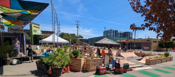
SE 7th Avenue & Sandy Boulevard Green Plaza
Depave
Portland, Oregon
The Challenge
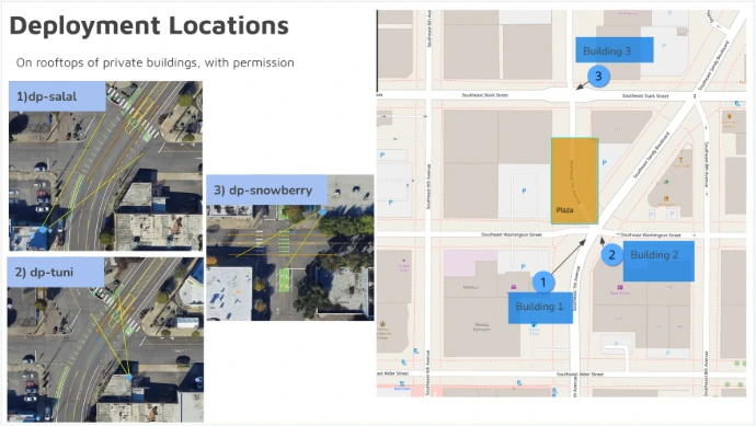
We provided a comprehensive sensor system of 3 devices to determine their program's impacts and success. Popup Plazas make for a tough data count, with pedestrian crossings, many bike lanes, 5 way intersection and more.
57 days
of counts on 3 devices deployed to private roofs
1,381
average daily pedestrians
19% decrease
in speeding vehicles
The Outcome
Depave is making better-informed design decisions and target specific interventions and pain points with partners and the City of Portland.

River View Cemetery
River View Cemetery
Portland, Oregon
The Challenge
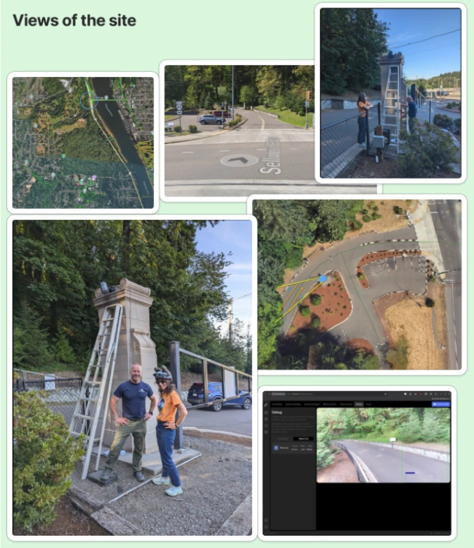
We provided pro bono traffic monitoring at the Macadam entrance to the Cemetery.
18 weeks
of continuous monitoring
386 vs 294
average daily bicycles in summer vs autumn
66% and 15%
of vehicles and bicycles were speeding, respectively
The Outcome
River View Cemetery is using the full analysis to work with advocates and municipals partners making data driven decisions about the use of their space.
Summer Programs Participation Counts
Lloyd Ecodistrict
Portland, Oregon
The Challenge
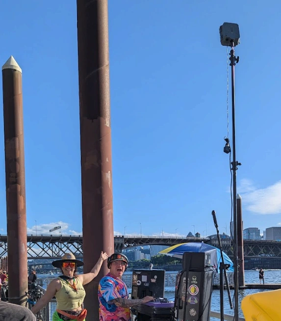
We provided EcoLloyd with low-cost traffic monitors, equipment, and training for their unique, temporary event monitoring.
20 events
using temporary tripods and batteries
88 dogs
in the annual Pups in the Park event 🐕
> 15k people
were counted across all events
The Outcome
Lloyd Ecodistrict had counts from 20 events to use in reporting, analysis, and grant-writing activities. They were able to get counts of people, bicycles, and even dogs in participating in their event areas.
NE Broadway Pave & Paint Construction
Private deployment, Sullivan's Gulch
Portland, Oregon
The Challenge
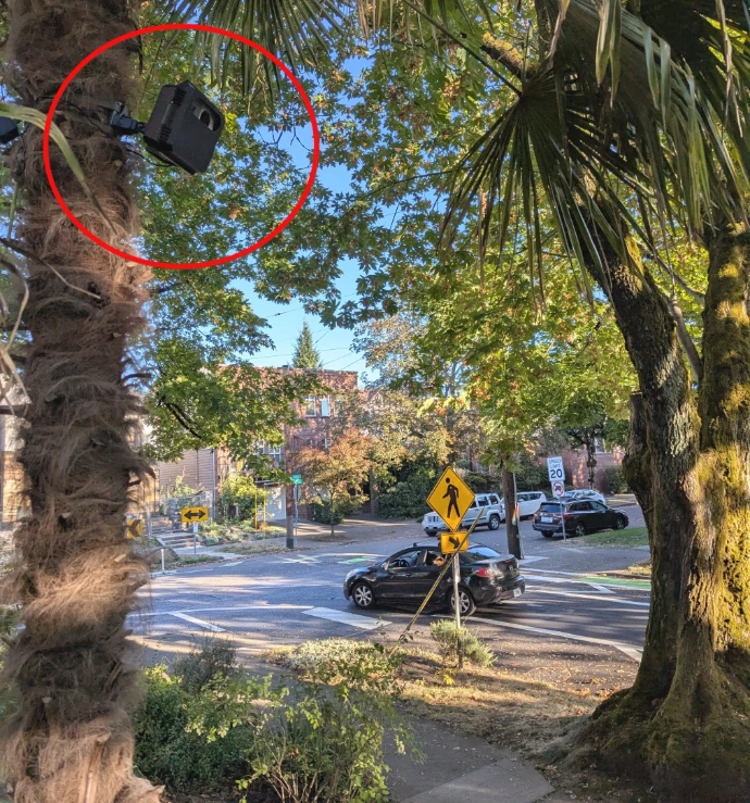
We provided a pro bono traffic monitor deployment to a neighbor that was interested in capturing how the roadway designs change driver behavior before, during, and after construction. This traffic monitor included full suite of sensors including camera, radar, and environmental monitor including air quality (AQ), combustion gases, particulate matter.
Improved AQ
Lower combustion gases, better air quality
6k cars
average daily vehicle count
90% decrease
in speeding vehicles
The Outcome
The neighbor was able to share with their neighborhood and the City of Portland how much more quiet and controlled traffic was through the area and suggest future low-cost changes across the city.
CREDENTIALS
Why advocates and municipalities trust Roadway Biome
Matt Zajack has spent years working directly with the advocacy communities this device serves. This is not a tech company that discovered transportation. It is a transportation advocate who built the tool the community was missing.
Direct community partnerships
Regular pro bono work with municipalities, nonprofits, and advocacy organizations. Deployments conducted and data interpreted alongside the communities that need it.
Published and cited work
Traffic Monitor work has been featured in advocacy publications including Strong Towns and Bike Portland, reaching the exact communities it is built for.
Open source community
The full hardware and software stack is public on GitHub. The project has an active contributor community. Transparency is built in, not bolted on.
As seen in...
WHY TRAFFIC MONITOR
Not all traffic technology is the same
Some tools are built for enforcement and surveillance. The Traffic Monitor is built for communities. That is a technical and ethical commitment baked into every design decision.
Surveillance-Based Tools
Built for enforcement
- Captures and processes video of individuals.
- Data sent to and stored on third-party servers.
- Proprietary algorithms. No transparency.
- Vendor controls the data and the platform.
- May require enabling legislation to deploy.
- Ongoing subscription or licensing fees.
- Raises civil liberties and data misuse concerns.
Traditional Traffic Engineer Tools
Built for the status quo
- Primarily measures cars, ignoring cyclists/ pedestrians.
- Intrusive sensors require specific modifications or placements; e.g. pneumatic tubes, roadway radars.
- Relies on expensive vendor-proprietary systems & data formats.
- Often involves costly recurring installation/maintenance fees.
- Reinforces existing infrastructure assumptions.
- Data access tied to contracts, limiting community use and involvement.
- Designed for specific engineering projects, not broad community advocacy.
Our Traffic Monitor
Built for communities
- Counts and classifies. Never stores images or video.
- All data stays on the device. Nothing sent to a server.
- Fully open source. Inspect every line of code.
- Owned and controlled by your organization.
- No enabling legislation required.
- Right-to-repair. No vendor dependency.
- Designed for advocacy, not enforcement.
Start collecting open source roadway data for your community
Pre-order the Traffic Monitor at a discounted launch rate and start building the evidence base your community needs. Hand-built in Portland, OR. Ships within a few months of order.